April 17, 2017
Middle School Eyes
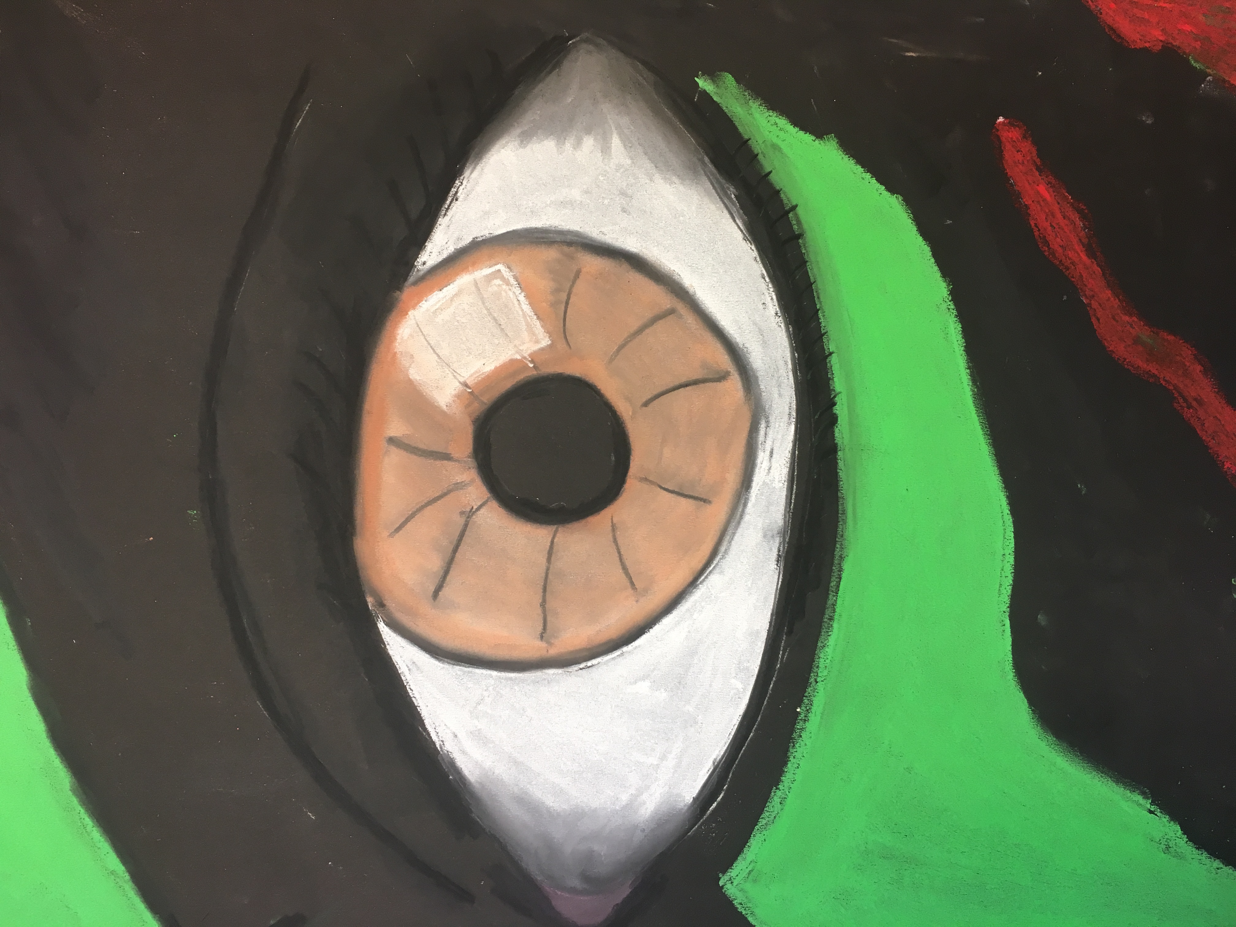
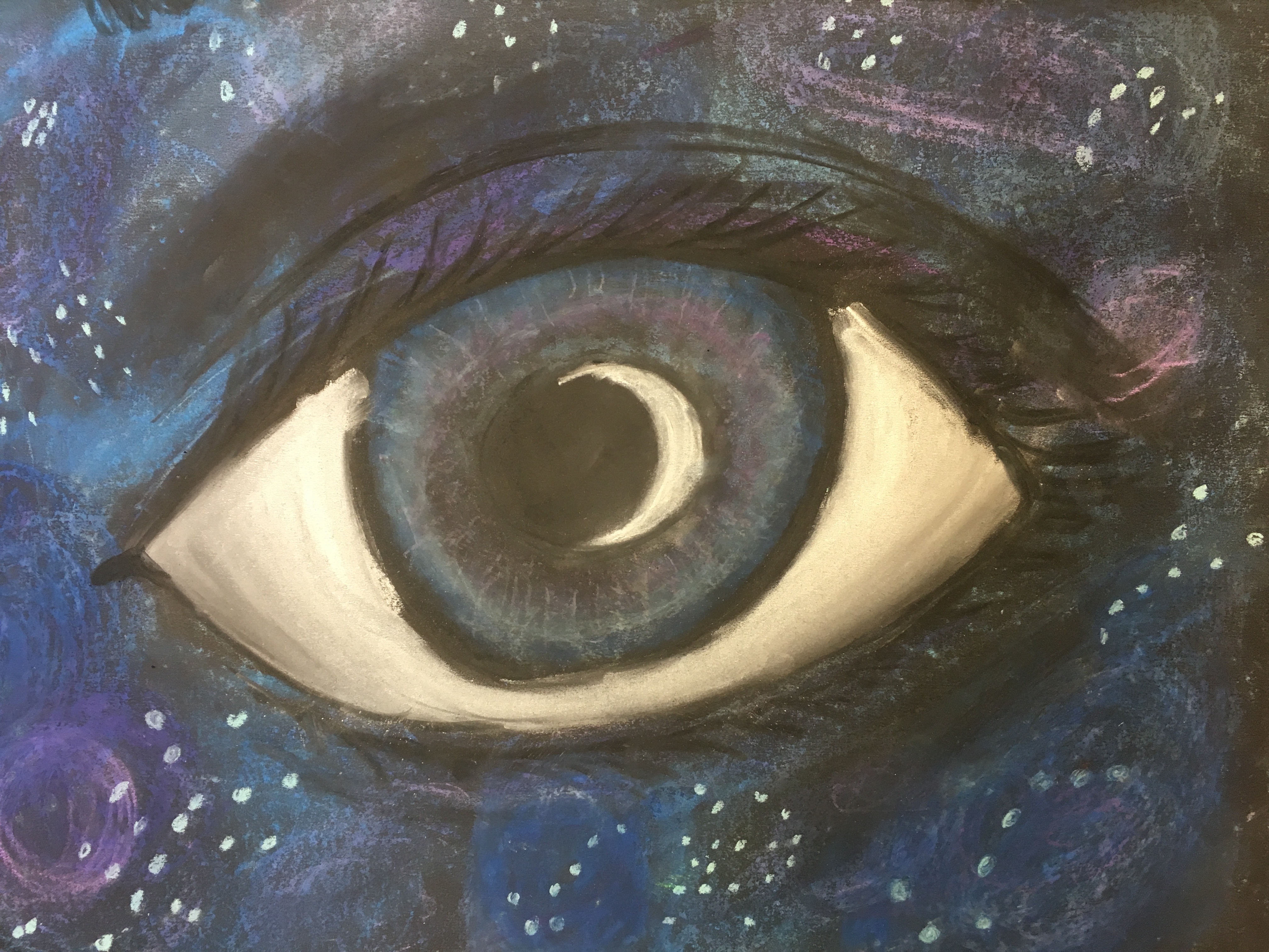
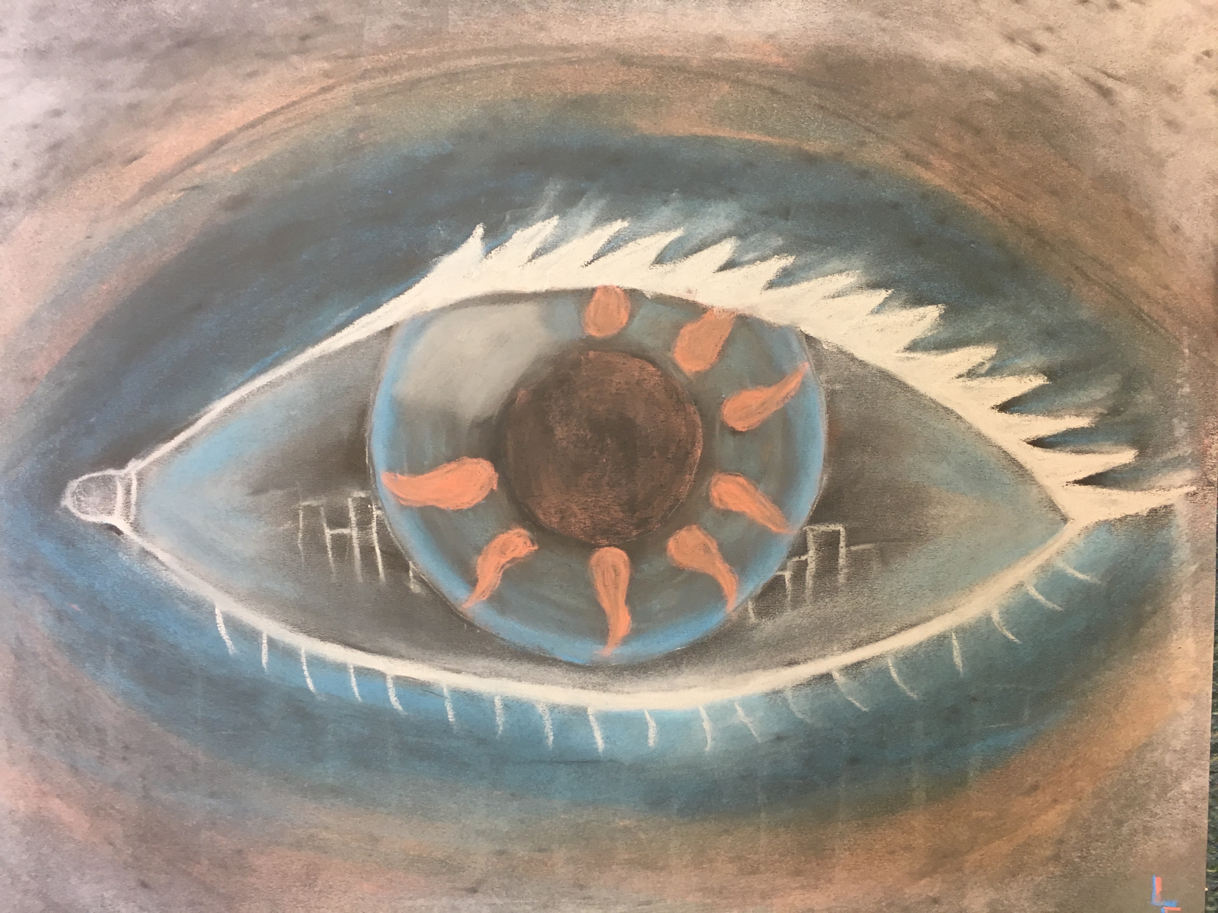
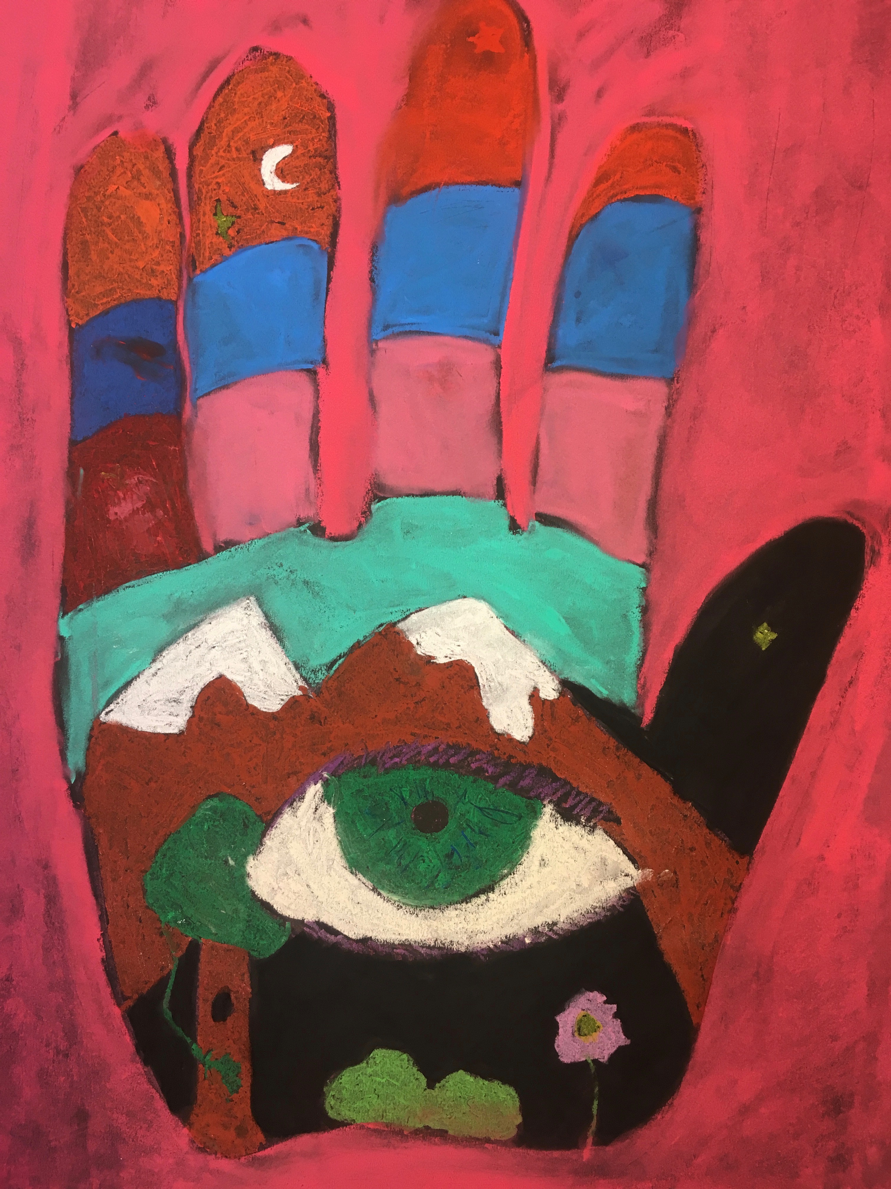
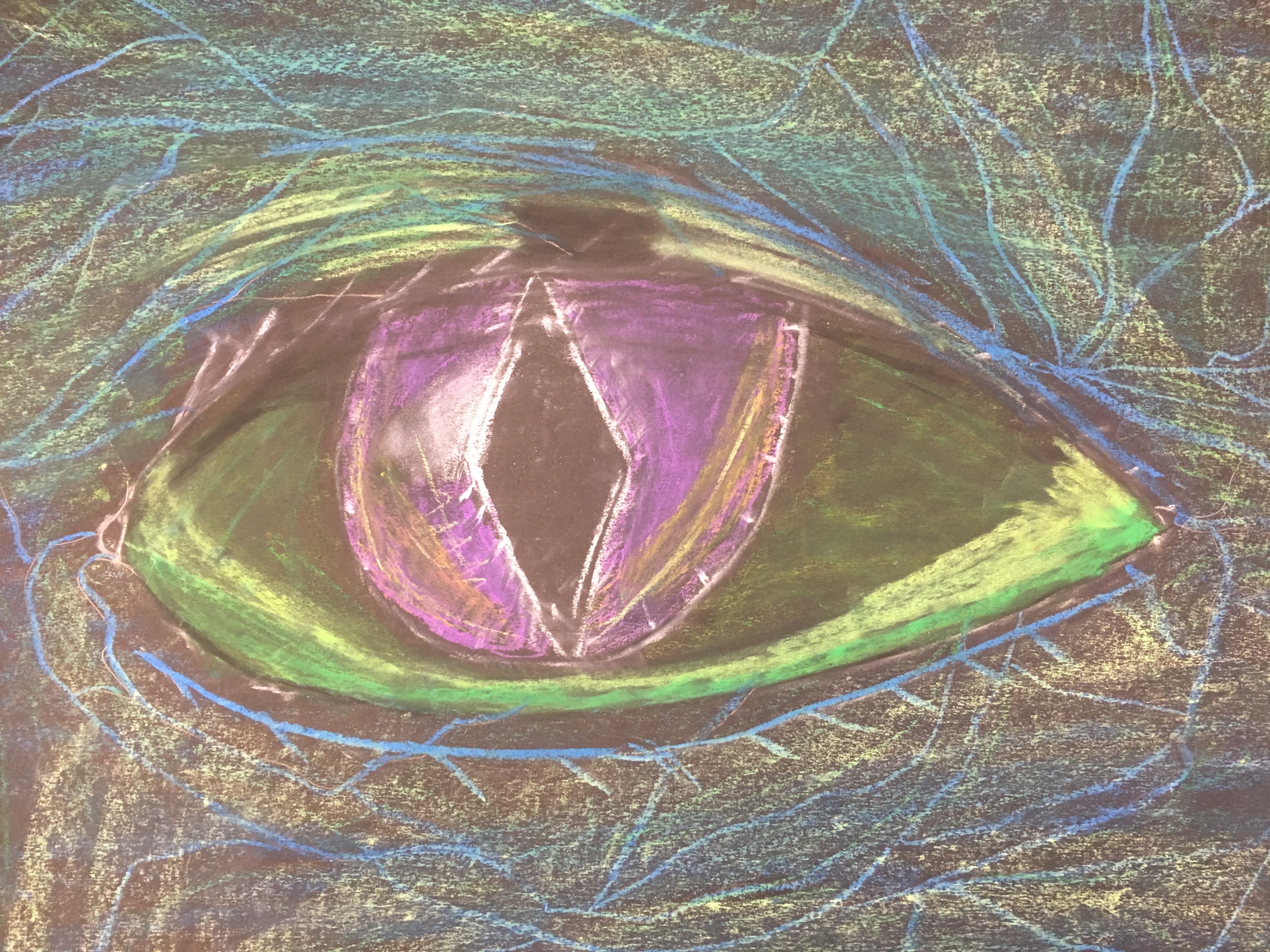
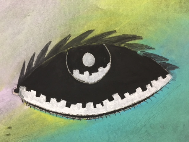
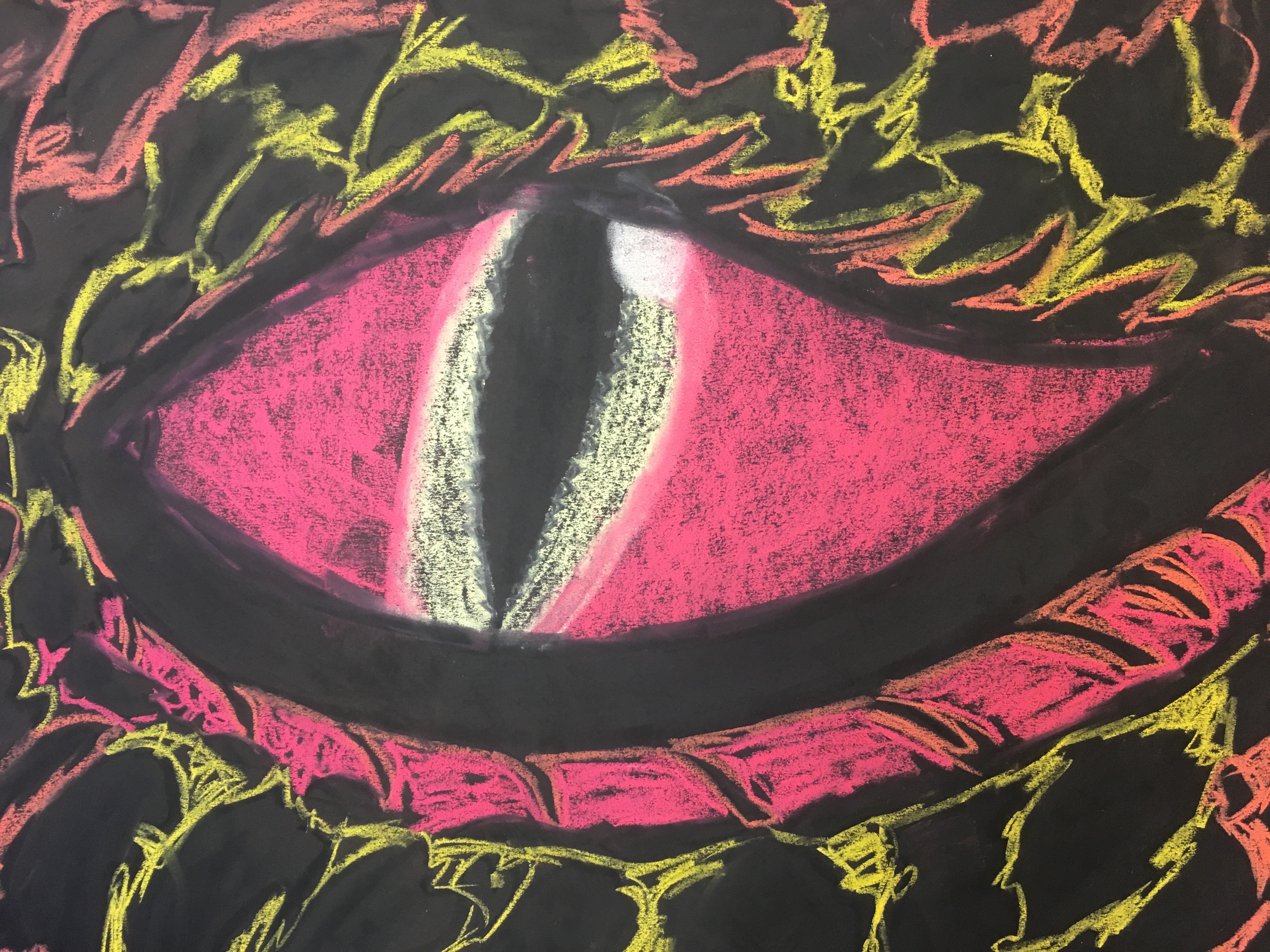
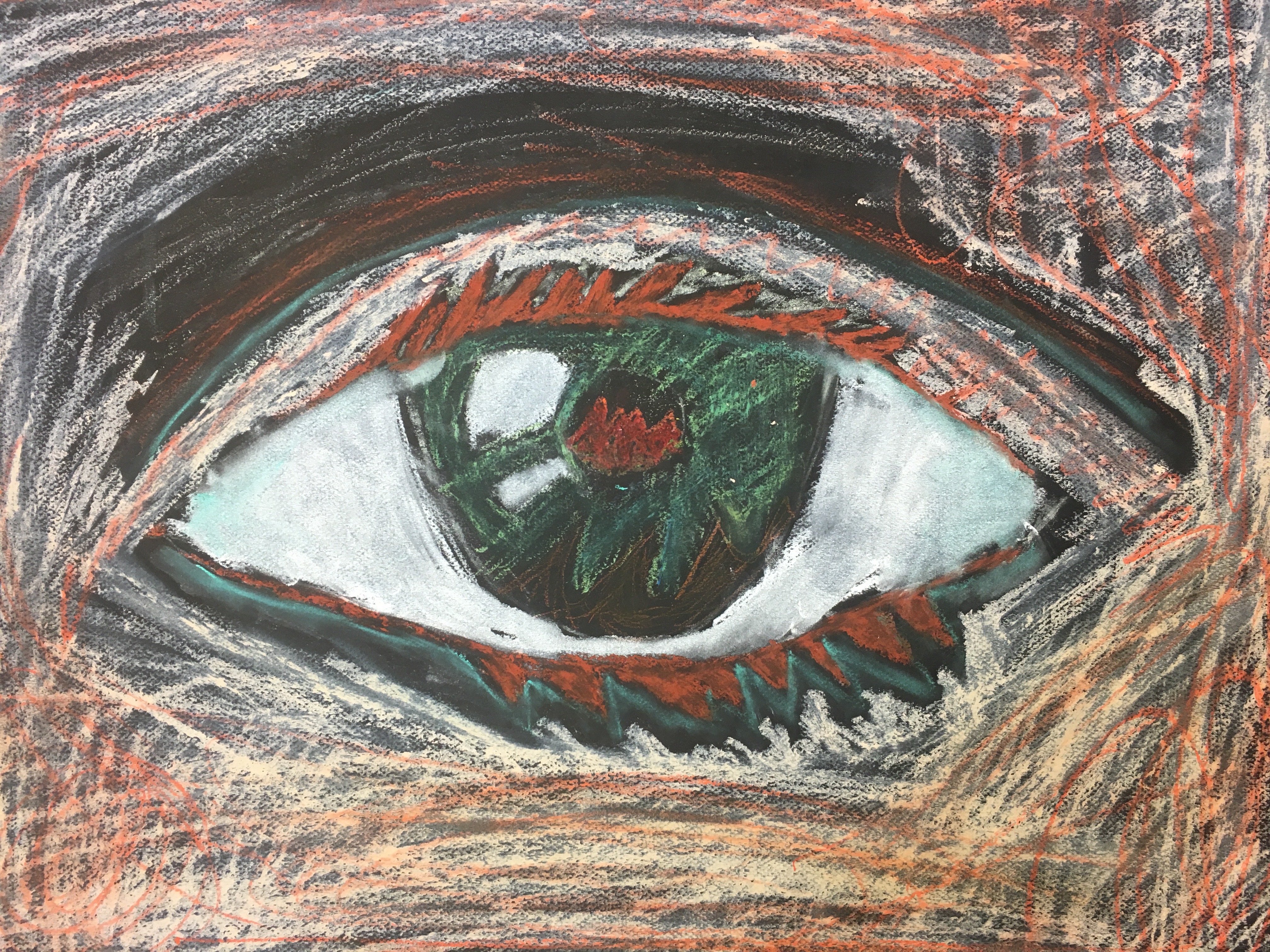
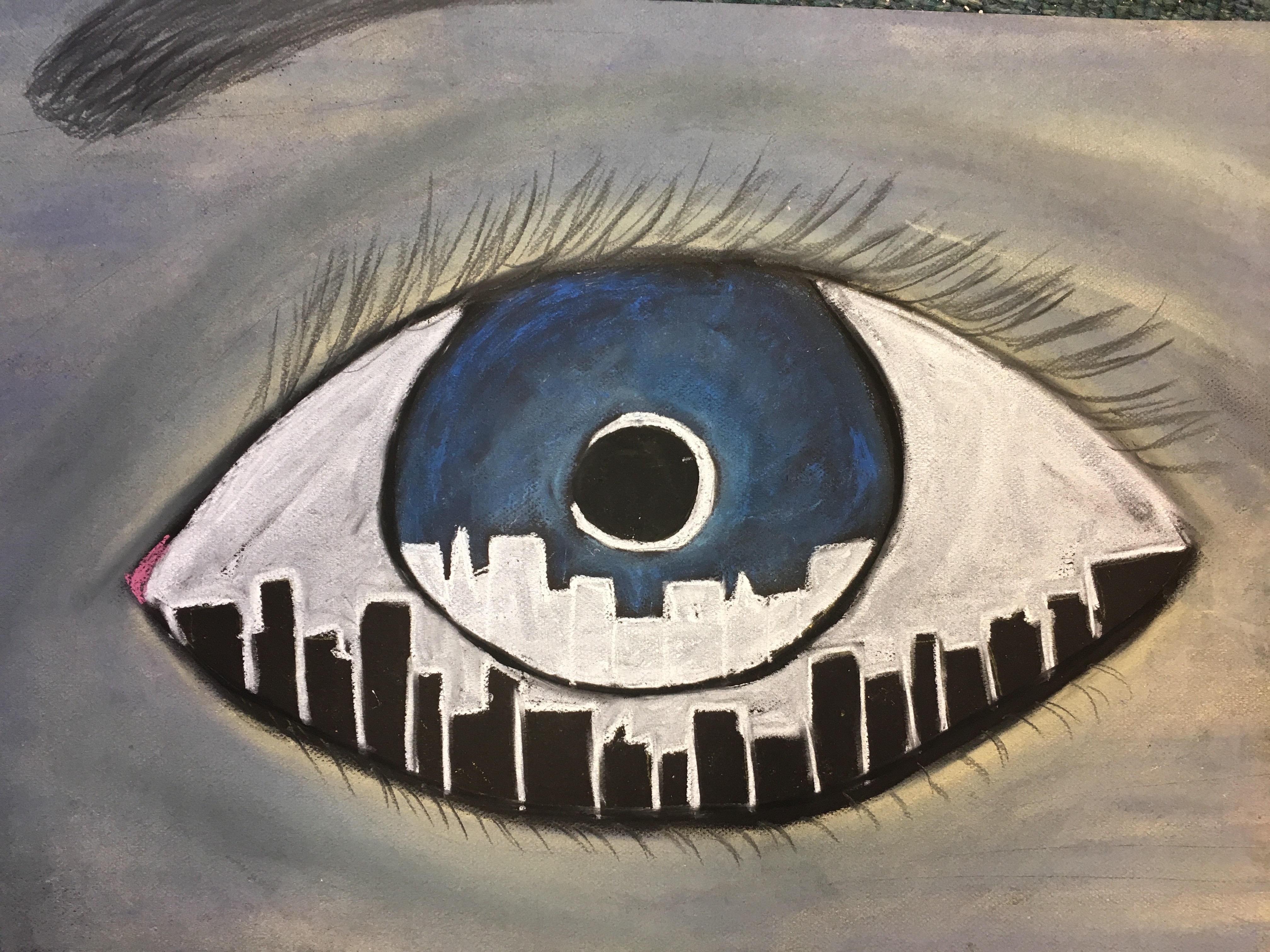
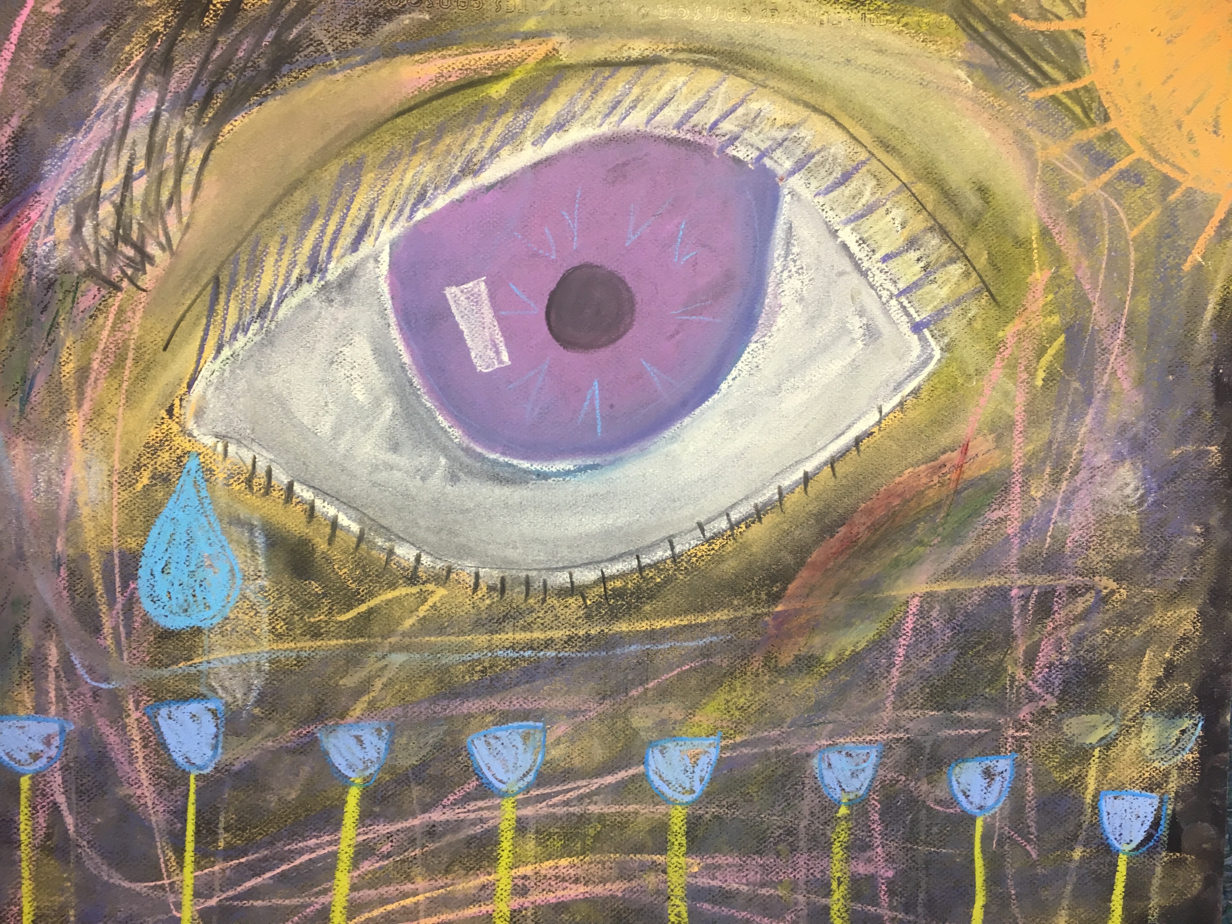
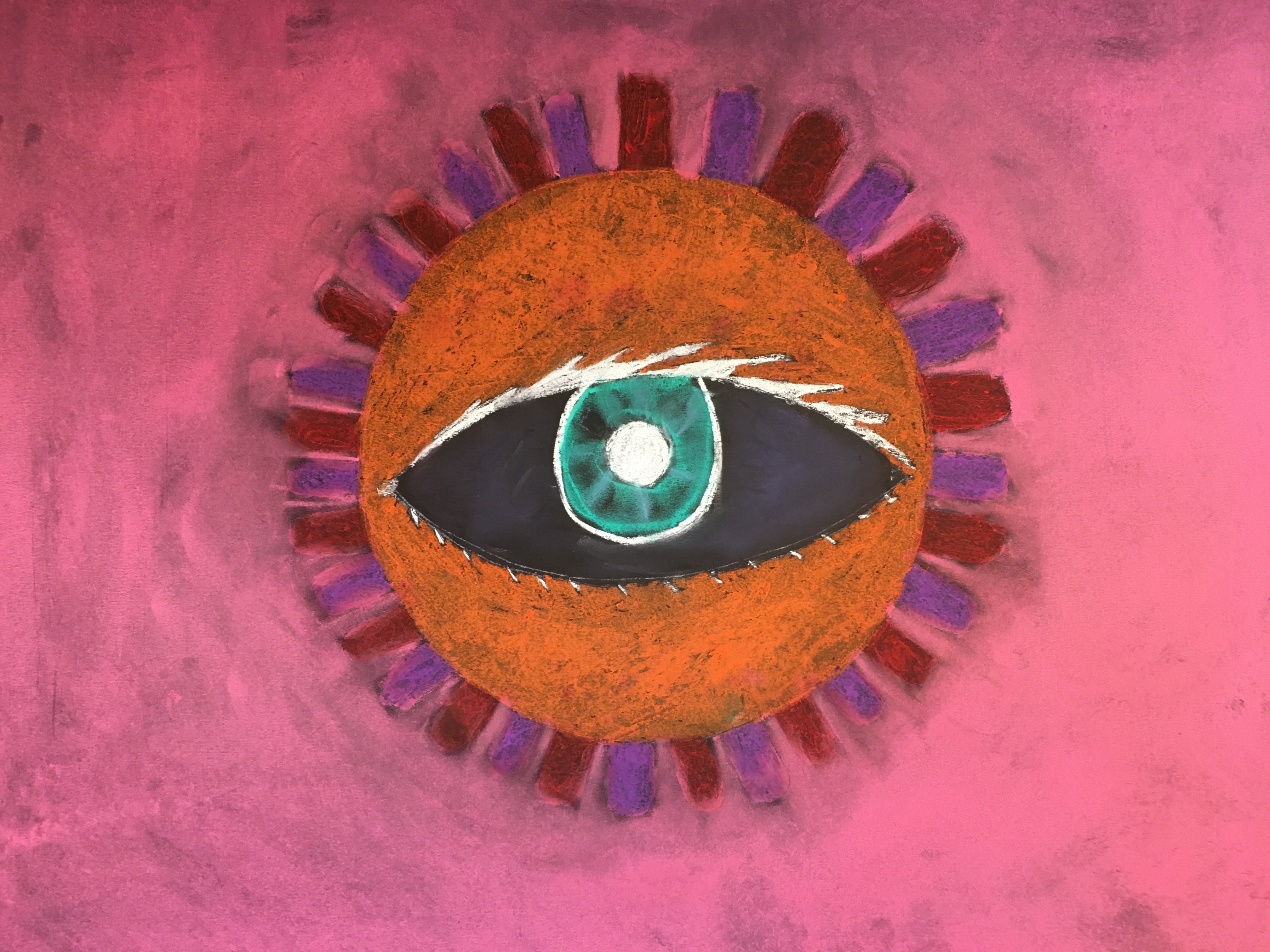
The eye is the window to the middle schoolers soul… 🙂 We studied and practiced drawing the human eye. The assignment was to draw an eye using oil pastel and chalk on black paper and to make something unique about it. Here they are, awesome job SMS Art students!
Jared Dean
Mikya Wallace
Lydia Jacoby
Ryker Bradford
Colt Ogle
Nicole Hettick
Marcus Lastimosa
Jacob Wendt
Emily Unrein
Linda Jack
Mary Withrow

Lucy Hankins
April 10, 2017
2017 KPBSD Art Show Awards!
The KPBSD Art Show happened last week with the top art from all around the district competing in a juried show! Seward High Art students took some awards, congratulations to Emma Moore for 2nd Place in Mixed Media, Case Estes for 2nd Place in Printmaking, and Josh Parks for 2nd Place in Watercolor! Meghan Mullaly took home an honorable mention in functional ceramics! Good job everyone!
Emma Moore Grade 11

Case Estes Grade 12
Josh Park Grade 9
Meghan Mullaly Grade 10
April 6, 2017
Kenai Fjords National Park Species Maps Assignment!
The Art of Mapmaking is called Cartography. Cartography (in Greek chartis = map and graphein = write) is the study and practice of making representations of the Earth on a flat surface. Cartography combines science, art, and technical ability to create a balanced and readable representation that is capable of communicating information effectively and quickly.
We are going to create maps of an area in Kenai Fjords National Park which include some of the local flora and fauna.
Here are some cool maps to check out and inspire you! What are these maps communicating other than the geography?
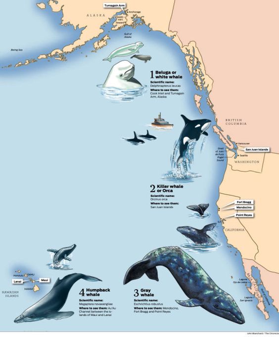
Pacific Coastal Whales
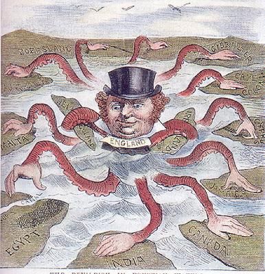
The Imperialism of Britain
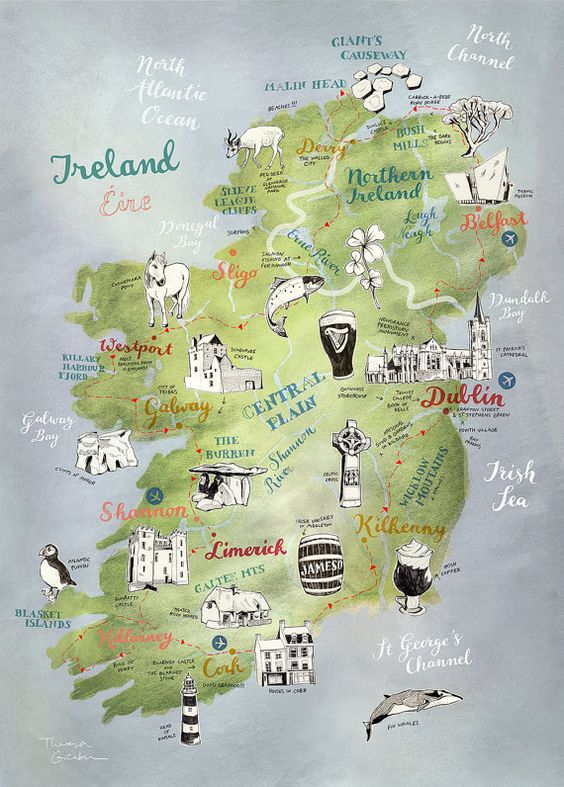
Places, Animals and Goods of Ireland

Species of New Zealand
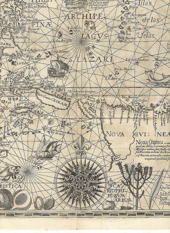
Compass Rose with Shipping Charts
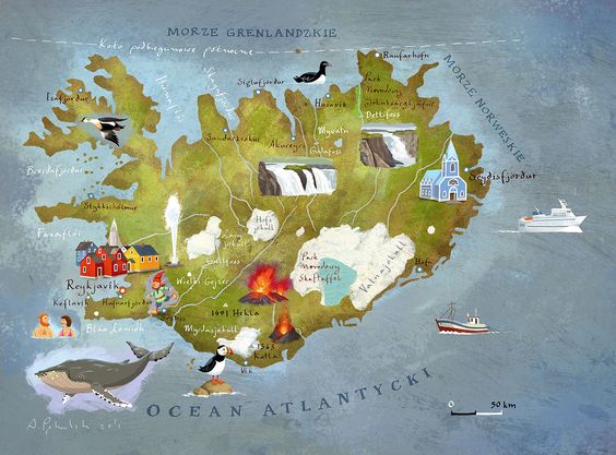
Greenland Sites and Species

Animals of the world
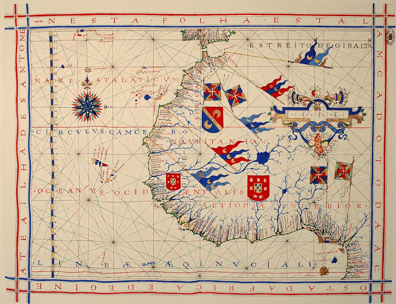
Empirialism in Africa – Different Shields of different ??
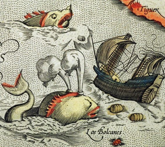
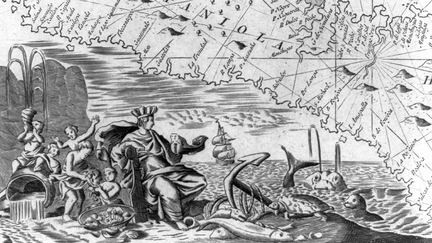
Sea Monsters!
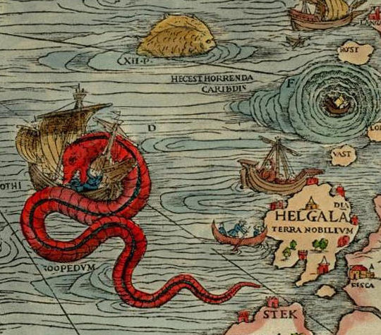
More Sea Monsters!

Florida Gators!
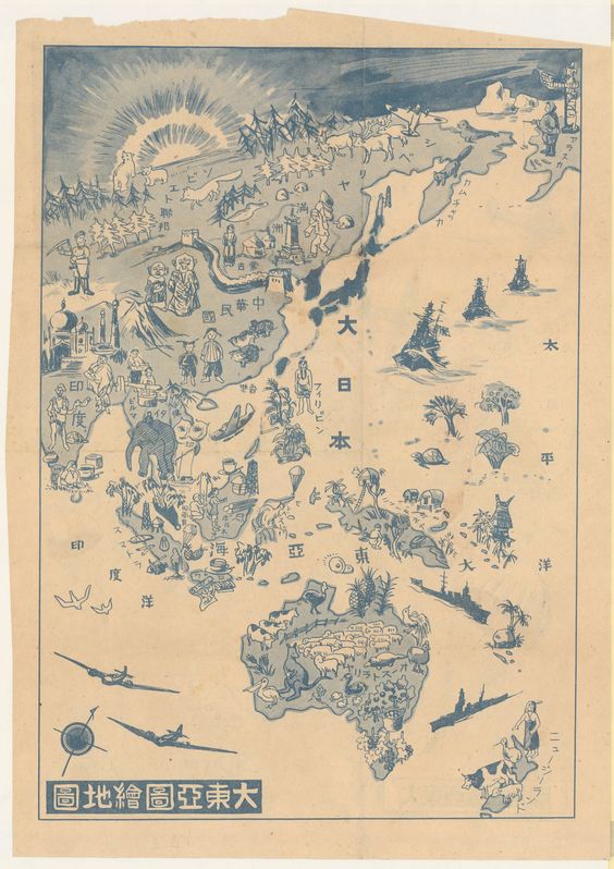
Different Ethnicities and species on multiple Continents
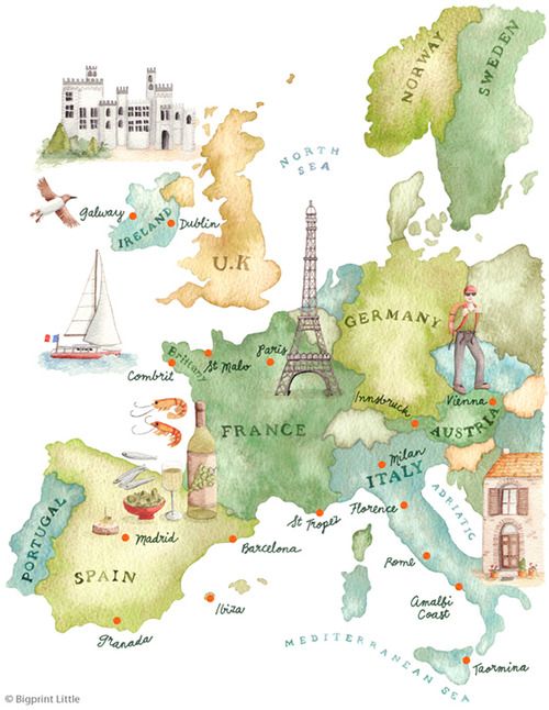
Tourist Destinations in Europe
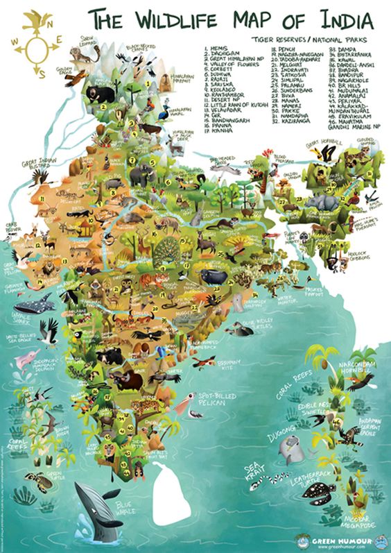
Wildlife in India
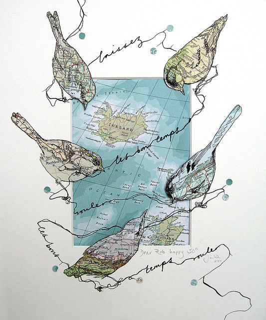
Birds and Iceland
Not sure but this seems to be about Imperialism too! Africa? Land of Plenty!
Alright lets take it back to home!
Here is an interactive map of the boundaries of the Kenai Fjords National Park!
It starts near Seward, wrapping around Exit Glacier and the Harding Icefields and extends all the way south west to Nuka Bay.
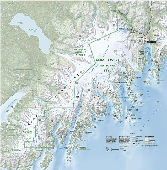
Here is an interactive shaded topography map of our area
Here is another topo map, with lines to repesent elevation gain.
Use these maps or another one you find to choose the area of the Kenai Fjords National Park you wish to illustrate. Zoom in and out to find an interesting section. Make sure it is actually in the park! Use the snipping tool to take a screen shot of the area and paste it into Word so you can print it out!
Assignment: Make a map of a portion of Kenai Fjords National park which communicates about the Flora and Fauna in our area (plants and animals)! You can do many small animals or a few bigger ones, up to you!
Include:
Mandatory Features:
Accurate Land/Ocean depiction
Fauna/Flora at least 3
Labeled names of ocean features (bays)/land features such as mountains and mines
Optional features choose at least three:
Compass Rose
Latitude/longitude lines
Nautical routes
Topography (mountains) either with topo lines or shading
Current patterns
Ships
Sea Monsters
You will be drawing your map by hand. The original cartographers weren’t able to use satallite images when they were making maps, they had to travel the land and figure out how to represent it on a flat surface! Make your drawing as accurate as you possibly can!
Once you have the map drawn out, add your features! No tracing for this either, but you may look at pictures of the flora/fauna you are adding!
Once it it perfected, trace your design onto watercolor paper.
Paint it neatly and have fun with the colors!
After the paint is dry we have new skinny sharpie pens in ever color to add details and lines!
Do your best and make your map awesome!